Odds & Ends
This page contains a variety of miscellaneous historical information which will be gradually expanded.
Ideas for new entries will be gratefully accepted!
Cricket in Denton
This information has kindly been provided by Steve Whiteman.
It seems likely that a Denton cricket team has played on at least five different grounds within the parish.
The oldest, and the most difficult to verify, seems to be on the southern upland area to the south of Vale Farm. The owner of the land has maps dated from the early 1900’s with field names, one of which is clearly marked Cricket Field.
Next, at the junction where Middle Road meets the top of Trunch Hill a footpath leads away to the west in the direction of Alburgh. There were two pitches to the right of this path and older residents in the village report that one was opposite the Watch House public house (closed 1962). It is reported that it was a frequently met challenge for batsmen to hit the ball into the pub’s orchard.
The second pitch in the same field was further down the slope. Part of the road frontage for these pitches has now been filled by bungalows.
The present Village Playing-field - the site most recently used for cricket - has hosted games against Alburgh and then Fritton (1999), as well as the less formal but equally memorable Craig Whipps’ Memorial matches.
Finally, cricket pitches and public houses were regular bedfellows in South Norfolk, and Denton was no exception. The last public house to close in Denton was The King’s Head on Norwich Road, in 1984, by which time the field opposite had hosted several games following the move from the pitch across the road from the Watch House.
Denton's Administrative History
Denton's parish boundaries were laid down in Saxon times by the church. They have probably not changed very much for more than a thousand years. The boundaries were originally defined by a number of physical features. These included significant trees and these were shown on the older OS maps. Locally they included an oak tree east of Middle Road and an ash tree near Denton Lodge. The part of the boundary formed by the river Waveney, the county boundary, will have moved as the river has changed its course but it is less than a mile in length.
One significant change, in 2018, saw the transfer of eight properties and 14 people, on the east side of the parish, from Earsham to Denton.
Under the Saxon system Norfolk was divided into 33 hundreds (nominally the area occupied by 100 households) and Denton formed part of the Earsham hundred.
The hundred system was swept away by the creation of Rural District Councils in 1884. Denton became part of Depwade RDC. Four year's later the Local Government Act of 1888 created Norfolk County Council.
The next Local Government Act, of 1894, created civil parishes, separate from the ecclesiastical ones, and parish councils. It transferred the civil functions of the older parish authorities to the new institutions. As a result, the church was excluded from formal participation in local government. Denton Parish Council has existed since that date.
The latest Local Government Act, of 1974, merged a group of small urban and rural district councils, including Depwade RD, to create the current South Norfolk District Council.
Great Green Windmill
In medieval times there would have been a parish watermill probably near the church on the Beck (it is mentioned in Domesday Book) to grind the village's corn but windpower was regarded as more reliable and in most areas watermills were eventually replaced by windmills.
Denton's windmill stood on what was originally Great Green, close to Darrow Green Road (marked as Windmill Road on old maps). It's age is not known but it was there in 1752. It is shown on Bryant's map of 1826 and the first Ordnance Survey one–inch map of 1838. It was a postmill, built on 5ft high piers and turned manually into the wind by a tail pole. It was demolished around 1899. The site can still be identified near Mill House, Mill Farm and Mill Cottage (Grid Ref: TM277898).
For a photograph of the mill and a lot more information go to The Norfolk Windmills site.
It has long been rumoured that there used to be another windmill in the South of the parish on Round House Hill on the site of what is now called Denton Cottage.
This is due to the existence of a round room, perhaps based on a former mill building, at Denton Cottage. However, there is no documentary evidence to support this and the current owners of the property claim that it is a misconception.
There may be a "Round House" on Round House Hill, but it seems it was never a mill.
Denton Workhouse
In 1601, during the last years of Elizabeth 1st's reign, the Poor Law Act placed the duty of poor relief on the parish. This continued until Gilbert's Act of 1752 allowed parishes to join together in Unions to build poor houses or "Workhouses".
The Norfolk Museums Service's "Historical Atlas of Norfolk" records that in 1832 Denton's Parish Workhouse, location unknown, contained 26 paupers and made out-relief payments to 108 men women and children - a substantial portion of the village population. Its location is unknown.
The 1834 Poor Law Union Act established the new Union system with workhouses in each single or grouped hundred. The Depwade Union's new building at Pulham Market (on the A140) served Denton and the parish workhouse presumably closed. The 1881 census records that four of the inmates were born in Denton. The Pulham workhouse building closed as recently as 1929. It served as the offices of Depwade Rural District Council and later as a hotel before conversion to its present use as flats, Hillcrest Court.
Further information is available at The Workhouse website.
This includes a plan of the original octagonal shape of the building now changed with the removal of some of the perimeter sections.
A Snapshot from the Past
Before receiving any poor relief or placement in a workhouse, applicants had to undergo an "Examination" before a magistrate. These were recorded in writing and stored in parish chests.
One such record, from the early 19th century, provides an interesting account of one Denton resident.
John Smith, a labourer living in Denton, reported that "In 1790 at Haddiscoe I let myself to James Elliott, Blacksmith, for one whole year. I continued for two further years, then went to Yarmouth and went apprentice to go to sea for three years. But after serving about 18 months I was pressed into HM's Service."
No details of how long he served in the Navy, but at that time, with constant wars against the French, he was probably lucky to survive. The use of Press Gangs to recruit seamen was a serious issue in ports like Great Yarmouth.
No record either of what "relief" he obtained.
Population Change
A national census has been held in the UK every ten years since 1801 (apart from 1941 because of the war). The figures for Denton appear below.
The highest figure recorded was 625 in 1841 and the lowest 325 in 1961. The latest censuses indicate that we are nearly down to that figure but the opening of the Affordable Housing scheme in 2011 and the change to the parish boundary in 2018 reversed the decline, at least for the time being.
More detailed census information is becoming available on-line. Appropriate links to these sources will be added to the list below.
- 1801 451
- 1811 498
- 1821 601
- 1831 580
- 1841 625
- 1851 571
- 1861 518
- 1871 525
- 1881 484
- 1891 451
- 1901 406
- 1911 376
- 1921 381
- 1931 337
- 1951 337
- 1961 325
- 1971 327
- 1981 382
- 1991 382
- 2001 352
- 2011 326
- 2021 358
Further census information on Denton is available from the Vision of Britain website.
Our Trigpoint
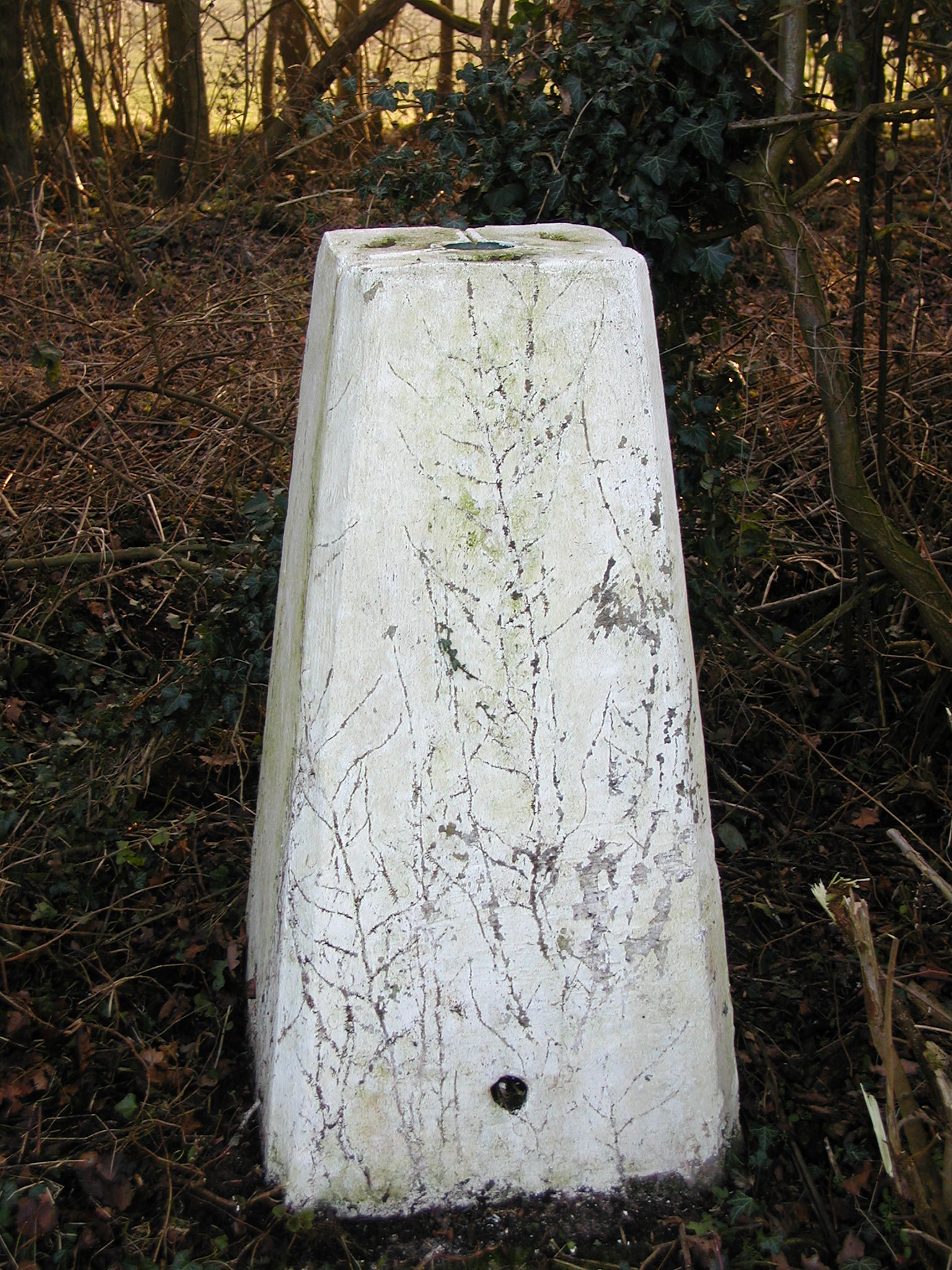
The Ordnance Survey Trigpoint - on the right -
(officially a "Triangulation Station") on the boundary with Topcroft (probably just in Topcroft but we will ignore that!) north of Darrow Green has a height of 52.6 metres (172.6 ft) above sea level.
Comparatively rare in Norfolk (because of the lack of hills most trig stations are on top of church towers, as at Topcroft), this was erected "on December 13th 1948 at a cost of £9 14s 2d" (£9.71). It is one of the 6,575 such points which originally covered the whole of Great Britain.
Some interesting information about the history of trigpoints can be found on the BBC website.
Officially this is called the Bush Wood TS, Ref. No. TG12/T10, it bears the flash number S4912. It's Grid Reference is TM26219019. It is one of the many trig points that the Ordinance Survey has now declared to be redundant; with modern satellite-based surveying methods far fewer fixed TPs are needed. It could reasonably be regarded as a modern "ancient monument".
The next nearest Trigpoints are: in Topcroft, 2.7 km away on the church tower; 7.2 km away south of Long Stratton just west of the water tower on the A140; 7.3 km away in Stony Lane at Pulham Market and 7.6 km away on the southern edge of Seething airfield.
Further information on Trigpoints is available from the Ordnance Survey and from TrigpointingUK.
Their reference No. is TP1814.
Misery Corner
The junction of Darrow Green Road and Manor Farm Road has been called "Misery Corner" for as long as people can remember. There are at least five versions of the origin of this name:
- A nearby field contains Hangman's Hill and the passing condemned were obviously having a pretty miserable time.
- It is thought that, before Denton Chapel was built around 1700, local non-conformists would meet for worship in a barn at Ivy Farm, one of the houses at the Corner, then owned by a Mr Primrose. With the non-conformist faith's strict restrictions on drinking alcohol and other pleasures, local Anglicans took to using the "Misery" title for that area.
- It is claimed that many years ago a young servant girl working at Ivy Farm, was so ashamed of becoming pregnant that she committed suicide by hanging herself.
In another version, she drowned herself in the pond outside the house. - During the Civil War some roundhead soldiers were billeted at Ivy Farm. One of them misbehaved (something to do with the servant girl perhaps?) and was duly executed by firing squad in a field by the Corner.
- Finally, it is suggested that at the end of the Civil War period royalist soldiers, also billeted Ivy Farm, were taken across the corner and executed on Hangman's Hill. As they were taken there they sang the Miserere and so Misery is a corruption of Miserere.
Denton's Pubs
Like most villages Denton used to have traditional public houses to provide suitable refreshments for its residents. Sadly they are no more though the Village Hall Bar does fill the gap pretty well.
They were two, one at each end of the village;
- The Old King's Head at the top of Nowich Road served the North end of the village.
- The Watch House on Trunch Hill, the South.
A Titanic Link?
Well, nearly. An item in the June 1998 issue of the Parish News recorded that,
by coincidence, the following item had appeared in a Souvenir Edition of the Daily Mirror, April 1912, which commemorated the sinking of the Titanic.
The grave is in good order, situated on the right hand side up the steps from the car park.
"My sole wish is that my name shall be utterly forgotten' runs a clause in the will of Mrs Mary Anne Pemberton, of Denton, Norfolk, who left estate of £19,349 gross value. Mrs Pemberton further desired: 'To be buried in the parish in which I may die, but my name is not to appear on any memorial tablet in any church. No music or singing shall be heard at my funeral (which is to be conducted like a cottager's funeral), and no leaves or flowers shall be placed in or on my grave. My tombstone shall not cost more than £3, and shall bear the inscription M. A. P."
Born Mary Anne Holmes in Florence in 1841, she was the widow of Walter Hamilton Pemberton, JP of Denton House who died in 1894.
A Public Inquiry
In 1988 the new owners of Pockthorpe Cottage, concerned to find a public footpath outside their front door, challenged its status.
What follows is a report of the subsequent public inquiry which also considered a proposal that Sidge's Lane should be recognised as a full bridleway rather than a footpath.
The report, written by the then Chairman of the Parish Council appeared in the Parish Magazine in December 1988.
"Denton Parish Council are most grateful for the public spirited response of so many parishioners who gave their time to attend the Public Inquiry into the status of Sidge's Lane and Pockthorpe Lane. Several people endured the whole two and a half days that the inquiry lasted; in fact many of us hadn't sat down for such a long period since we left school!
We are particularly indebted to Mr. Peter Hill, who conducted the appeal over the status of Sidge's Lane which we are endeavouring to return as a bridleway. The professional manner in which he correlated the evidence and presented the case was a great help and the fact that he was personally congratulated by the Inspectors on this presentation must stand us in good stead. Thank you, Peter, for giving your time and experience to help our cause.
Some of the evidence was very interesting. We heard how Mr. Joe Revell and other farmers along Middle Road brought their horses and farm tackle to the blacksmith's shop, run by Mr. Harry Fairhead (Geoffrey's grandfather), and how other farmers such as Jim Brooks and Billy Constance used the lane when carting corn and feeding-stuffs by horse & cart from Earsham Mill. Both old & young gave evidence of use on horseback over the past forty years, one lady welcoming the flooded and over-grown conditions of the lane to train her horses for ''eventing''.
Pockthorpe Lane witnesses found it a much more daunting experience when faced with cross examination techniques which seemed more suited to the Old Bailey. However, after initial nervousness some witnesses actually managed to bring some humour into the proceedings. We learnt quite a lot about Haggard's Farm, and the fact that the lane led to a field called “Common Field”. This led to interesting observations on the title ''Common Way'' which erring clerks over the centuries had sometimes spelt with a capital “C” ' which would signify, after long Latin deliberations, ''Public Highway”, but at other times they used a small ''c'' which could signify the use of the owners of a right to the common land.
Other interesting uses of the lane included nature rambles, bird nesting, short cuts to work and Sunday School, children delivering lunch packs to the farm workers, courting and sometimes nocturnal uses when a 'glint in the eye' speaks volumes!
As it was recently reported in the press that the Dickleborough by-pass inquiry was not published until eleven months after the decision was made, we are likely to need a lot of patience as we await the vital pronouncements on our two ''green'' lanes, but, whatever the outcome, everybody did their best and it was very much appreciated by your Parish Council.
Some months later the Inspector's report came out in favour of the PC. Pockthorpe Lane continued as a footpath and Sidge's Lane became a bridleway.
The Village Shop
This section, much expanded, has been moved to its Own Page.
Early Closing Day
It was Wednesday, though, since the closure of the Village Shop in 1991, this has largely lost its significance.
The Village Sign
As fully restored in 2024.
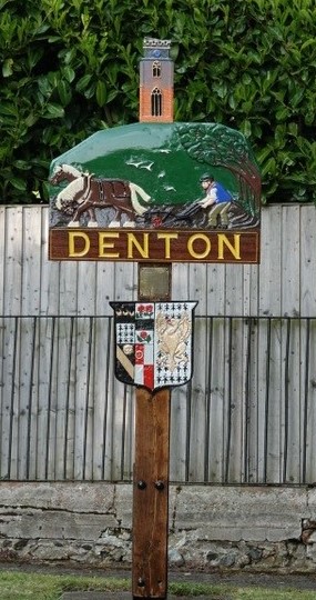
In October 1970 Denton WI, on the occasion of their Golden Jubilee, offered to pay the cost of erecting a Denton Village Sign.
This offer was accepted, with thanks, by the Parish Council who agreed to take over responsibility for its future maintenance.
The sign was designed by Clarence Reeve from Mettingham who helped with the creation of a number of such local signs around this time.
The design incorporates the arms of the D'Albini family, who built
Denton Castle and were the first Norman Lords of the Manor.
It was duly erected in 1971 in the Pocket Park near the junction of Danacre Road and Church Hill.
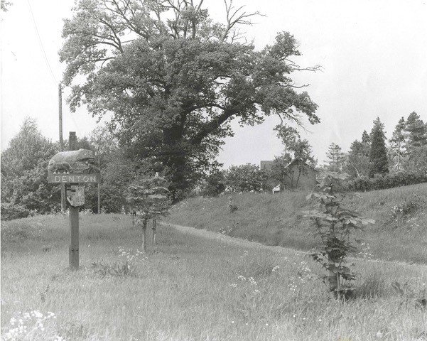
It stood there until the late 1990s when it was badly damaged by a falling tree.
A Denton resident, Charlie Richards, provided a new post to support the sign and local artist Dawn Creasey from Flixton was
employed to restore, improve, and repaint it.
It was then moved to its current location in front of
the Old School House at the bottom of Trunch Hill.
In 2007 Roger Dove provided suitable wood to repair the top.
However, by 2008 the weather had done its worst and Dawn was again needed to restore the paintwork. Terry and Lucie duly re-erected it.
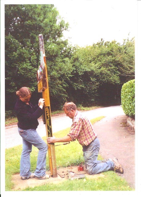
Finally, fingers crossed, in 2024 yet another major restoration was completed.
The team were in action again.
A Possible Alternative?
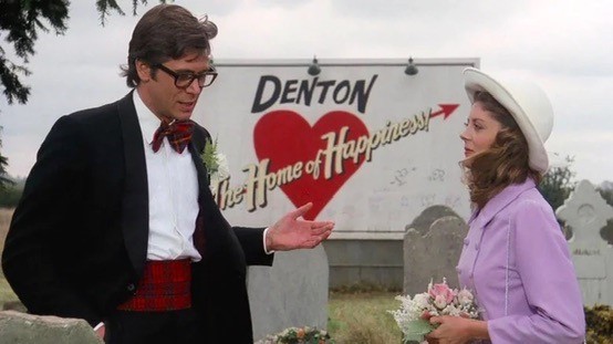
In December 2021 an alternative Village sign was proposed, based on the one used for Denton, Texas in the Rocky Horror Picture Show film.
